Sunday, 26 January 2014

Burros and Bridges and Bungles, Oh My!

Moving day is coming up next week... I'll be off to Vegas for February. Time to reflect on some of the places caching has led me here in the tristate area.

Grapevine Canyon is a sacred area for the Yuman and Numic speaking indigenous tribes on Spirit Mountain near Laughlin NV and features over 700 petroglyphs. They were created between 1100 and 1900 AD.


It isn't without its share of naturally sculpted wonders:


Oatman is a ghost town in the Black Mountains of Arizona. It was posthumously named after a woman who was kidnapped as a child by a Yavapai band of Indians who murdered most of her family, later sold to the Mojave tribe and released after 5 years. Oatman bills itself as "the ghost town that ain't dead yet". Wild burros roam the streets, and many of the stores sell burro chow. There are signs in English asking people not to feed them on the wooden sidewalks, but no signs in Burro telling them they're not allowed inside...

Got Chow?
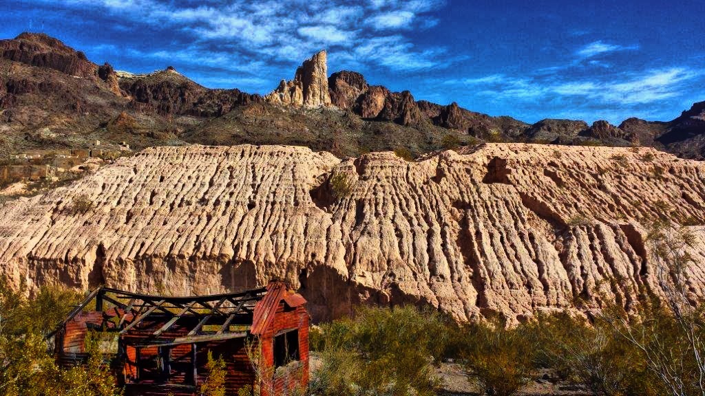
Here's a scenic vista on the outskirts of town:


Many of the creosote bushes on the way into town had been decked out for Christmas:

Arizona Christmas Tree
Lake Havasu City is home to the old London Bridge, which was disassembled, shipped over and reassembled as a tourist attraction. I can see the seasonal wreath, but the Old Girl just looks out of place with palm trees...


I discovered some soldiers' graffiti dated 1942 under the bridge, and found out later that it was two Americans who left it when posted in London:


In Golden Shores, AKA Topock, I got to not only drive ON Route 66, but THROUGH it:


And in the spirit of "leave 'em laughing", I visited the Von Schmidt State Boundary Monument, a site of monumental Government ineptitude. When the line dividing California and Nevada was surveyed in 1873, an iron column was erected at this line's southernmost tip.


A later survey found that the original marker was 3/4 mile south of where it should have been (ah... what's a measly 4,000 feet between friends...?). When in 1974 California and Nevada each erected their own monument here to commemorate this original erroneous survey, Nevada's plaque included not just one, but two critical California place name spelling errors.

California Knows Their Own Place Names
Nevada Doesn't


Saturday, 18 January 2014

Life is a Highway

gettin' my kicks on Route 66
It's been a busy time here since I arrived in Mohave Valley. It's in Arizona, but is very close to the borders of both California and Nevada. One day I got caches in all three States.

Shortly after getting here, I noticed that I was close to 3,000 finds so thought I'd target that milestone before my "cacheversary", my first year of caching on Jan. 23. I got to that pretty quickly, and decided that if I really pushed it, I could get to 4,000. I've been boots to the caching trail ever since. With only a week to go, that milestone is now easily in sight, so I'm treating myself to a slow day to catch up on the blog, email, laundry etc.

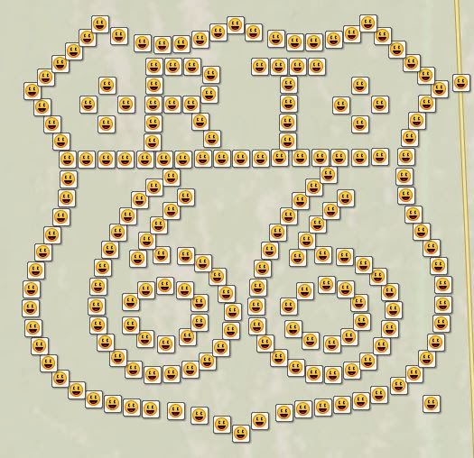
I spent a couple of days hiking a 200-cache geoart just off old Route 66, with a familiar design:


It was a lot of fun trekking through the desert. It started with a favourite container... an "ammo can", with extra pill bottles to replace any missing en route:


I found several abandoned tortoise shells, reminders of the harsh environment in the desert.


 Since my decision to push for the 4,000 mark I've also done 500 of the 800-long Route 66 power trail (caches every 528 feet or so, right on Route 66). The first 60 or so I did by mountain bike. Most of the time, these were 35 mm film canisters, placed under rock piles (some of which weren't actually easy to spot):

Somebody, perhaps "tired" after doing all 800, left this marker by #800:


I saw some iconic places along the way. The well known Road Runner Retreat is in (still recognizable) ruins, but the most famous is:


Roy's, which opened in 1938 at the height of the "Mother Road"'s popularity, is in Amboy (founded 1838), which now bills itself as "the ghost town that ain't dead yet". After many years in decline, it is being restored for the nostalgia tourist trade, and a number of films have included scenes shot here. The cache outside the cafe was in a tucked away "Route Beer 66" bottle.


There were many other amazing sights along the "Main Street of America". It has become a tradition for people to use rocks to spell out names and messages along the embankments. Some are quite colourful:


...some are cryptic:


...and some are monumental (many of these rocks have "Ed and Karen" painted on, with different dates):


I stopped at Amboy Crater, an 80,000 year old extinct volcano.


Since I was on a push to get 200 caches that day, I didn't hike up and into the crater itself, as that was a 3 hour return trip. I did pick up the Earthcache in the parking area though.

There have been lots of other interesting things to see here, including Bullhead City, Oatman, Needles and Topock, but I'll save them for another post.